

The Banstead Image Library
WWII Surrey Bomb Site Map


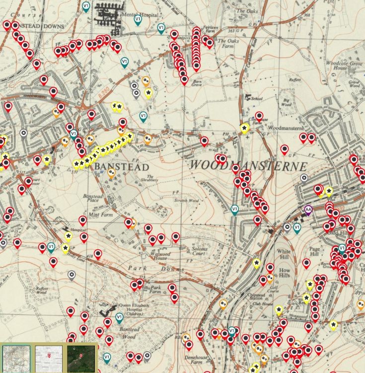
This image is a screen shot from an interactive county map just published online by the Surrey History Centre.
See more details below from Martin Stilwell.
====================================================================================
The Surrey History Centre is carrying out a 2+ year project to map all bombs (and V1s, and aircraft, and…) that fell on Surrey in WW2. The project is over half way through and we are loading the data as and when it is ready.
Banstead data has just gone live (Feb 2025), mainly compiled from the surviving 1945 bomb map and the ARP records, as well as personal information from on line records, including the BBC archive.
The resulting interactive map is phase 1, and for many incidents will be all that exists, but there will often be records and personal stories from those still with us, who would have been children at the time, which will be added as the map matures.
The map is in the public domain and can be found here: Exploring Surreys Past and we would be delighted to add/correct any information shown. The map is currently centred on Effingham but you can zoom in and out and navigate to Banstead and the local area.
If you click on an icon a pop-up appears and there is a “Read more” link to a pdf that gives all the details. It is that document that we are hoping the public can provide more details for.
I am giving a Zoom talk on the progress of the map on Wednesday 12th Feb 2025 at 5:30pm. Details here: https://www.surreycc.gov.uk/culture-and-leisure/history-centre/events
All submissions to this site will be checked by members of Banstead History in the first instance, then forwarded to me at the SHC.
Regards
Martin Stilwell
Project Lead Volunteer Researcher
Surrey History Centre, Woking
Picture added on 01 February 2025 at 12:10
This picture is in the following groups
No Group allocated
No Group allocated
External Links
Banstead History
Banstead History
A more precise link www.exploringsurreyspast.org.uk/themes/subjects/military/second-world-war/bomb_damage/world-war-two-bomb-damage/
Added by Michael Funnell on 05 March 2025
The map is post WWII and some of the houses didn't exist in the war. According to my father many bombs that hit the chalk eg on Epsom Downs buried their way in and weren't found. I was told the bomb on Chapel Way wasn't found.
I think the V1 shown as falling very close to Great Burgh is mispositioned and should be close to Shawley Wood. I just about recall a demolished house on the bend in Shawley Way (one more or less on its own as far as I can remember) and my father said it was a V1. Also this would make more sense in the description. If it had been so close to Great Burgh there would have been much more damage to that building. But the SHC can only rely on the best descriptions they have.
I think the V1 shown as falling very close to Great Burgh is mispositioned and should be close to Shawley Wood. I just about recall a demolished house on the bend in Shawley Way (one more or less on its own as far as I can remember) and my father said it was a V1. Also this would make more sense in the description. If it had been so close to Great Burgh there would have been much more damage to that building. But the SHC can only rely on the best descriptions they have.
Added by Michael Funnell on 05 March 2025
Banstead


